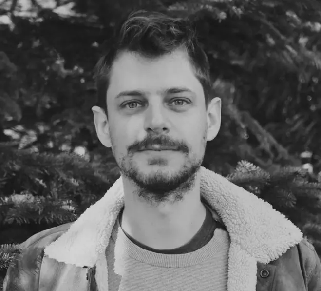
Erik Escoffier Interactive maps,
data-driven experiences,
and information design ⨳

I am a front-end engineer with 10 years of specialised experience in maps and data visualisation.

From contributing to large codebases to building small experiences from design to backend: I'm both a team player and highly autonomous.

The main focus of my work is climate change, sustainability, biodiversity, oceans, and renewables.

featured projects

Food Twin Earth Genome

Recent global events have spotlighted vulnerabilities in food system models and their effects on food security. In response, The Plotline, affiliated with Earth Genome, collaborated with Development Seed to develop a digital twin of the US food system. By overlaying US highway data onto the system, users can pinpoint possible chokepoints in food distribution. Simultaneously, the tool represents the real-world threats of climate stresses on crop yields, like heat stress or drought, visually informing users of the regions most at risk. The integration of deck.gl provides a vivid rendering of particle layers, representing calorie flows, while Mapbox GL brings static layers to life. When toggling the roads mode, the particles will follow the US highways network (a simplified version), giving a great visual sense of potential bottlenecks, places isolated from the central system, etc. Switching this off emphasises absolute calorie flow numbers and crop groups relative to each other. When roads are turned off, particles follow generative paths that are drawn like waves.

Our Forests Tomorrow Development Seed

EU-Trees4F is a study examining the potential future of 67 distinct tree species across Europe according to several dispersal and climate scenarios. This project aims at revealing the fascinating insights of the paper with charts, an explorable map and elements of scroll-driven narration. This is a project I intiated and prototyped, which eventually became a Labs project within Development Seed, and is still under development. I'm the sole developer working on this project, involving mostly frontend work, and preparation of datasets with QGIS and tippecanoe. I gathered interest around the project and got to work with a designer, a data scientist, and the lead author of the study. The WIP project: Our Forests Tomorrow

GlobalFishingWatch map GlobalFishingWatch

The GFW map allows governments, fisheries managers, researchers, and journalists to explore human activity at sea. Powered by satellite technology and machine learning, the map merges multiple types of vessel tracking data to provide a view of global human activity at sea, including fishing activity, encounters between vessels, night light vessel detection and vessel presence. Users can navigate historical data, search, analyze, and filter through about 70,000 fishing vessels. I was one of the core frontend engineers, specifically designing and engineering highly customized solutions for visualizing spatiotemporal data, with Google Maps, then Mapbox/Maplibre, then deck.gl. Explore the map

An Ocean of Books Google Arts and Culture

When I was part of the Satellite Studio collective, Google Arts & Culture commissioned us to explore a two-dimensional dataset produced out of about 150,000 books, based on their relationship on the web. We ideated, designed and engineered an explorable gigantic map of authors and books. This map was built with Mapbox GL, and a lot of time spent behind the scenes to generate a massive realistic geography out of thin air, using QGIS, tippecanoe, and tilereduce.Explore the map

other projects

who I've worked with

my expertise

  • Front-end development:
    Javascript, TypeScript, React, Redux/RTK, jotai, Next.js
  • Back-end development:
    Node, SQL, Postgre, PostGIS, GCS
  • Maps/GIS:
    Mapbox|libre GL JS, deck.gl, Leaflet, QGIS, gdal, turf, tippecanoe, tilereduce, mapshaper...
  • Data visualization:
    D3, Vega Lite, Observable
  • Currently learning:
    Python, Django, Flask, three.js, messing with stepper motors and Arduino.

selected talks

about me

Erik Escoffier

My name's Erik, I'm a frontend engineer based in beautiful Brittany in France (hence the .nz TLD which stands for "Neolithic Zone"). I'm a happy husband and father of a little boy. I was born in the eighties at 344 ppm CO₂.

Lately I've been reading on: forestry, AI, carbon footprinting, disruptive action, solar panels, punk gardening, feminism. As for fiction: Ursula le Guin, Amin Maalouf, Orson Scott Card, Claire Duvivier.

I wish I could say I'm an avid trail runner, but that would be slightly exaggerated. I do enjoy running as much as I can though. I'm training in forestry as a side hustle. I also enjoy photography, cooking, prentending I buy Lego for my son (but common, let's be honest).

I lived in France, the Netherlands, and Spain. All three countries are dear to my heart and are part of my identity. I'm fluent in each countries' respective outdated memes.